Brief History of the District:
Indore is situated between the two earthly abodes of Lord Shiva- the two Jyotirlingas at Ujjain and Omkareshwar – on either side of this blessed city, which protect it from the evil, says folklore. Historian Raghuvir Singh is of the opinion that it was only in the 17th century thatIndore underwent rapid metamorphosis, finding a respectable mention as a Kasba in the court records of Emperor Aurangazeb. By the 18th century, it had developed as a chief administrative headquarter – as a Pargana.
History bears testimony to the fact that the progress of Indore was initiated with the arrival of Marathas in 1703, who made the best of the weakening grip of the Mughals. Simultaneously, in the Malwa Plateau, Indore came under their focus. The year 1730 brought autonomy to Indore when the Peshwas gave the Jagir of Indore to Malhar Rao Holkar.
Tracing the etymology of Indore, we come across several interesting facts. One is that it got its name Indrapur from the famous Rashtrakuta ruler Indra, whose empire extended over the entire Malwa region. Indrapur became Indoor and finally it became Indore. Another legend holds that in the year 1741, the Indreshwar temple was built and it is after the name of this temple that the region was named Indreshwar, to be subsequently renamed Indrapur. Under the influence of Marathas, it began to be called Indoor. It is interesting to note that the Britishers pronounced it as Indoure, which eventually became Indore.
Dr. V.S Vakankar on the basis of his study of the excavated articles came to the conclusion that they were about 3,800 to 4,000 years old. Articles recovered from the Kaitha and Maheshwar excavations besides the Dhanberi excavation can be dated back to the Harappan civilization, while the script was identical to that of Mohenjodaro civilization.
After passing through many hands, Malwa went to a Nagar Brahmin Giridhar Bahadur, who vehemently opposed the influx of the Marathas. On the 6th January 1818, after the signing of the Treaty of Mandsaur, the capital was transferred from Bhanpura to Indore. The Residency at Indore was built in 1818. In 1844, Tukoji Rao Holkar ascended the throne. The reign of Holkar dynasty continued in Indore till India got Independence in 1947.
The famous Parmar Rulers of Malwa made Dhar their capital, which became a great centre for education and trade in that era. Indore, which is situated near Dhar, can also boast of temples and idols of Parmar era.
Ahilya Bai Holkar has been a ruler par excellence who ruled but did not reign the Holkar State. She is known as a pious lady who made her name immortal in the annals of rulers of India as inheritor and preserver of Indian culture, religion and tradition, through charitable activities all over the country. Not a single place of pilgrimage one can locate on the map of India, which could not receive her attention for construction of temples, dharamashala and annakshestra. Though an administrator of a small state, yet she ruled over the heart of people all over the country. Even Mahadji Scindia was no match to her, who had complete hold of the politics of her age without participating in it actively. She can be called as the greater upholder of all religious beliefs.
Yeshwant Rao Holkar I was a ruler who ruled the Holkar state believed in the dictum, “might is right”. His claim to succession hardly acknowledged heredity, still he became the ruler by sheer dint of dauntless courage and diplomacy. In foresight he may be regarded as the first who could think in terms of nationalism and forming of national coalition of rulers of India against the British. He was extremely agile. He was so much on the move that he is known to spend evenings at Ratlam and mornings at Khandwa. As a commander and soldier, he won battles and defeated enemies with much larger armies.
Tukoji Rao II the founder of institutions, paved the way for the development of modern Indore. He being a minor at the time of succession resulted in formation of Regency Council which was successful in implementing several reforms in the State. The Maharaja had the privilege of attending Viceroy, Lord Canning’s durbar at Jabalpur in 1860 and welcoming Lord Northbrook and the Prince of Wales at Indore in 1876. He was an able administrator in whose close surveillance; a good number of new departments were organized. The credit for this may be shared with Sir. T. Madhav Rao KCSI, the Minister.
He was instrumental in solving knotty issues relating to neighbouring states including Baroda and Dhar, viz., the “Shoe Question” and “Dhar Case”. He developed cordial relations with most of the progressive rulers of India. Since Tukoji Rao III was not adult, a council of Regency was formed to run the administration of the state and this system continued upto 1911. Shivaji Rao was given a pension of Rs. 4.00 Lakhs per annum, who now shifted to the Daria Palace of Barwaha on the banks of the Narmada. However, form this new abode, Shivaji Rao remained active against the British. He made secret trips to Rajasthan and some other princely states of India to mobilize them against the British, till he left for his heavenly abode on 13th October, 1908.
The Nationalist Movement in Indore began during Shivaji Rao’s reign and continued even after his demise, when a council of Regency under the British was running the Indore administration. The Nationalist Movement picked up momentum in the guise of the Shivaji Utsav. The citizens of Indore started celebrating them as solemn occasions for taking oath of freeing the motherland from foreign rule. Lokmanya Bal Gangadhar Tilak had converted the Ganesh Utsav as a nationalist means of mass mobilization. This strategy of Tilak was most successful in various cities of Maharashtra besides Indore. Gradually, the mass participation of Indoreans on Shivaji Utsav and Ganesh Utshav became a cause for concern for the British, who suspected that many intellectuals and government servants were using these festivals to spread the message of nationalism.
An important aspect of Indore’s history is that the establishment of factories, especially textile mills in the city, laid the ground for organized labour unions for safeguarding the rights of workers. The Nationalist Movement in Indore got a big boost by Mahatma Gandhi’s visit to the city on 30th March 1918. In 1921, political activities of the city established the Indore branch of Indian National Congress. The congress party head office was in Chhawni and Shri. Arjunlal Sethi became its first President. In the same year Indore Rajya ‘Praja Parishad’ was also established, which subsequently passed a resolution asking the then Holkar Maharaja Tukoji Rao III to implement a responsible administrative set-up in the state. This democratic demand against royalty was crushed cruelly and harsh orders were issued, threatening the very existence of Praja Parishad. However, in spite of state repression, the political activities of Congress and Praja Mandal continued unabated, though in a somewhat secretive manner.
The trend of political party formation began in 1921 with the establishment of the Indore branch of Indian National Congress. In 1932, the Hindu Mahasabha came into existence, while in 1936, the Communists made their debut in the trade union and political arena. In 1946, the Socialist Party added a new dimension to Indore’s political scenario. In the post independence era, all these political outfits duly entered the electoral arena.
The birth of the new State of Madhya Bharat was heralded by the inaugural speech of Pandit Jawaharlal Nehru at Gwalior on 28th May, 1948. The district of Indore became one of the 16 districts into which the state was then administratively divided. In order to satisfy the feelings of the people of the erstwhile state of Gwalior and Indore, it was decided that the headquarters of both the States, viz, Gwalior, and Indore would enjoy joint capitalship and that the Government would work at Gwalior for six and a half months in a year, and for the remaining five and a half months the capital would be at Indore.
In the period between 1948-56, popular ministries administered the State of Madhya Bharat. Liladhar Joshi headed the first popular Ministry in Madhya Bharat. Later G.K Vijayavargiya, Takhtmal Jain and Mishrilal Gangwal became the successive Chief Ministers. On the eve of the reorganisation of states, Takhtmal Jain was holding the office of the Chief Minister. This arrangement continued till 31th October 1956, when a new state of Madhya Pradesh was reorganised, under the Chief Ministership of Pandit Ravi Shankar Shukla. The new state was born on 1st November, 1956.
Physical Features:
Indore district of the Indore commissioner’s division lies in the heart of Malwa. The extremities of this district measures from 22 degree-20' N to 23 degree-05' N. latitudes and from 75 degree-26' E to 76 degree-14' E. longitudes. It is bound in the north by Ujjain district, in the south by West Nimar district, in the north east by Dewas district and in the west by Dhar district. Physically the boundaries of Indore district stretch mostly along the natural features on three sides, viz. the Kshipra river in the north east, the Chambal in the west and the water-parting line of the Vindhyas in the south between the Karam and the Choral rivers, both flowing into the Narmada to the south. As per the Census 2011, its geographical area is 3898 sq.kms.It is the 43rd largest district in respect of area, which is 1.3% of the total area 308,245 sq.kms. of the state.
Indore is situated at an altitude of 553 meters above sea level on the banks of two small rivulets, the Saraswati and the Khan. The whole of Indore district is situated on the plateau of Malwa, which is scarped by the Vindhyas in the south. The general height of the district is about 1,800 feet (548.64 meters). The Vindhyan range occupies an important place in Hindu mythology. The chief legend relates how Vindhya in a fit of jealous rivalry with Meru (Probably a part of the Himalayas) attempted to surpass the sacred mount in height but was constrained to bow before the Sage Agastya Muni, his teacher and has ever since borne an inferior position. The main section of this range, which forms an abrupt termination to the Malwa plateau, runs with an average elevation of 1900 feet (579.2 metres) above mean sea level in a general east to west direction across the district.
The major part of the district, north of the main line of the Vindhyan hills, is a wide undulating plateau with low flat-topped hills spread here and there, a typical feature of the trap covered Malwa region. The plateau ranges in height from 1,600’ to 1,900’ (487.7 to 5791.1 metres). It slopes from the Vindhyan range in the south to the north and is drained by the Chambal and its tributaries, viz. Gambhir, Khan and Kshipra all flowing parallel to it in the district. The exile of the denuded Vindhyan hills stretches in the southern part of the district in a direction from west-south-west to east-north-east. A major part of the southern boundary is marked by the water-parting line. As the drainage of the district is directed towards the north by the general slope, the less dissected parts of the plateau and the residual hills stands alienated in a north-south direction, spurred from the main ridge in the south. The ruggedness occupies the southern half of Mhow tahsil except some area around Manpur, Mhow and Simrol. Two spurs, those of Singarchori and Lila, extend toward the north, past west and east of Mhow, respectively and occupy the southern parts of Depalpur and Indore tahsils, respectively. The southern-eastern part of Indore tahsil is rugged partly due to the presence of steep hills and partly due to the deeply eroded narrow valleys of the streams joining the Narmada. In the western spur lies the Janapao hill, from which the Chambal and Gambhir take their rise. Singarchori (2,891’ or 881.18 metres) is the higher point on the Malwa plateau. Other important peaks in the district are Janapao (2,803’ or 854.35 metres) which has a temple on it with mythical associations; Dhajari (2,768 or 816.25 metres): Rankta (2,569’ or 783.03 metres); Machal (2,006’ or 611.48 metres); Ralamandal (2,569’ or 783.03 metres); Kakri Bardi (2.451’ or 747.06 metres); Karband Machla (2,506’ or 763.83 metres); Tikki (2,387’ or 727.76 metres); Lila (2,200’ or 670.56 metres) and Naharkhadra (2,804’ or 854.661 metres). Many of the hills bear the remains of old forts, mostly Grasia strongholds of the unsettled days of the 18th and early 19th century whence the petty Rajput chiefs set out on their marauding expeditions. The fort of Kosalgarh founded by Kosal Singh is the best preserved.
Rivers :
The drainage of the district is divided into two great systems, viz, that of the Ganga and the Narmada.
The Chambal :
The Chambal, or Charmanwati of the ancient times rises from the western slopes of the Janapao Hill (2,803’ or 854.35 metres) about 5 kms south-west of Mhow Cantonment. The nominal source is marked by a tank and the temple of Janakeshwar and is the scene of a religious fair in the lunar month of the Kartik every year. The river has a northerly course and forms the western boundary of the district at three or four stretches near Gharbilod, Gautampura and Chambal (now Gautampura) railway station. It flows for over 66 kms. within the district and receives the Bagerinala from the west. Outside the district it is joined by the rivers of Malwa Plateau and in turn, joins the Yamuna (Jamna) river.
The Kshipra :
Shipra, Kshipra or Avantinadi is the stream on which the sacred village Shipra is situated. The river is said to have sprung from the blood of Vishnu, the God in the most worshiped form of a man, and as in Abul Fazl’s days, it is supposed to flow with milk at occasions. It rises from Kakri Bardi hill about 12kms. south-east of Indore city. After flowing for about (20.9 kilometers), outside the district, it receives river Khan from the west and joins the great Chambal.
The Khan :
The Khan river, a tributary of the Kshipra, rises from a hill near village Umaria about 11.42 kms. south of Indore. It flows through the city of Indore and also through the town of Sawer. One of its streams enters the Residency limits of Indore where it has been dammed to form a few artificial lakes. The Katkianala is a major tributary to this river, which joins the river Khan near Sanwer where there is a small temple, dedicated to Sangam Nath, the lord of the confluence. The Khan joins the Kshipra in Ujjain district.
The Gambhir :
The Gambhir rises from the eastern slopes of the Janapao hill in Mhow tahsil and flows to the North, past Mhow and later on forms the boundary between Depalpur and Indore tahsils. It joins the Kshipra about five miles south of Mahidpur in Ujjain district. Two dams have been constructed across it at Berchhia and Badarkha to supply water to the Mhow Cantonment and Indore, respectively. The second dam has created a large reservoir and is known as Yeshwant Sagar.
The Choral :
It rises near Chhota and the source is marked by the temple of Jam Darwasa. It flows to the north-east for about 23 kms. and then turns to the right, taking a south easterly course through its deep narrow valley. Cutting across the Vindhyas, it leaves the district near village Kundia and joins the Narmada near Barawaha. This river rises in the northern slopes of the Vindhyan hills but drains into a river south of it.
Water Falls :
Waterfalls of low heights provide picturesque sights at several places in the district. Most of them are on the upper streams of the rivers; Gudin Kho and Hatyara Kho on the Kshipra, Khudel and Tinchhaon, the Kanar Nala near village Tillore, Patalpani on the Gambhir, only two miles to the south of Mhow; and another Patalpani (Mendikund) on the Choral river near the village of that name.
Lakes and Tanks :
There is no natural lake in the district. Among those, created by the construction of dams across rivers and nalas YashwantSagar, Depalpur, Berchhia, Pipalyapala, Bilaoli, Sirpur Khajaralya, Haselpur, Sukhniwas and Yashwant Nagar tanks are worth mention. Yashwant Sagar is the largest 4.48 kilometres long along the course of the Gambhir river and about (0.8 to 4.83 km.) wide. The dam is about
6.44 kilometres long near the Indore-Depalpur road. It supplies water to Hatod and the city of Indore. Depalpur tank is the second largest in size and is created across the Banera Nala very near to Depalpur town. Berchhia Banera Nala tank is 69.656 km. south-west of Mhow Cantonment. Pipalypala, Bilaoli and Sirpur are near Indore. Haselpur and Yashwant Nagar tanks are near the villages of their name on the Mhow-Manpur road. All these tanks supply water to the settlement near them. Khajralya tank is about 4.83 km. south-west of Depalpur. Yashwant Sagar, Bilaoli and Sukhniwas tanks have been taken up for Government pisciculture.
Climate :
The district of Indore experiences monsoon type of climate. Since the region is located in the interior of the sub continent, the modifying effects of sea are meagre here and the climate shows some continental contrasts.
The district enjoys a pleasant climate and except during the monsoon season the climate is dry. The hot season commences from March and continues to about the middle of June after which the monsoon season commences and continues till September. October and November constitute the post-monsoon and December to February is the cold season. As the monsoon sets from 15 June, the rainy season begins. The advance of south-west monsoon from Arabian seas causes the rainfall over the district. The average rainfall in the district is 1044.4 mm in 2009-2010. The southern portions of the district get more rain than the rest of the district. The rainfall is mainly confined to the monsoon season when
the district gets 91 percent of annual total, July being the month with the heaviest rainfall. This number is fairly uniform over the district. The heaviest fall of rain in 24 hours amounting to 293.4 mm. (11.55") in the district occurred at Indore on July 27,1913.
Meteorological data available for the observatory station at Indore may be taken as representative of the condition in the district as a whole. The cold season starts, by the end of November and extends up to February, January being the coldest month, with the day and night temperatures slightly lower than in December. In the wake of cold waves in the winter season minimum temperature sometimes goes down to about the freezing point of water. After February temperature progressively rises and by May and June, it reaches its peak. Just before the onset of the monsoon, maximum temperature is on an average about 41 degree C. The maximum temperature sometimes reaches 44 degree C. During the monsoon the weather is cool and pleasant. After the withdrawal of the monsoon towards the end of September day temperature rises in October reaching a second maximum. Thereafter temperature decreases and winter condition sets in the later half of November. Except during the monsoon months the atmosphere is generally dry. In the post-monsoon and winter months humidity goes down to 40 percent in the afternoons while in the summer months air is considerably drier with relative humidity of as low as 10 to 15 percent. Skies are clear or lightly clouded. In the monsoon season overcast or heavily clouded skies are common. In the summer and monsoon months winds are strong. During the monsoon they blow mainly from direction between south-west and northeast. In the post-monsoon and the winter months morning winds are light and are mainly easterly or north easterly.
Flora and Fauna :
The total area under forest of Indore district in the year 2010-2011 was 709.85 sq.kms. out of which 666.93 sq.kms. was under reserved forest and rest 42.92 sq.kms. as protected forest. The forests of Indore district can be classified under the tropical dry deciduous forests, which are commonly known as Central Indian type. In eastern, south eastern and south western parts of the district there are low and high rock hill on which Khakra, Dhak or palas (Buteamonosperma) ,Babool (Acasiaarabica), Khair (Acacia catechu), Khejora or Rinjda (Acacia leuophloca) and shrubs like Dhaman (Grewiatilaefolia), Khejra and Kargara (copparis) and Karaunda (Carrisspiranum) are still found, General quality of teak
or Sag and Sagwan (Tectonagvandis) and Tendu (Diospyrostomentora) are also found in the forests of this district. The depleting density of forests and also decline in forests area in Indore district, have resulted in abnormal monsoon and deepening of ground water level.
The district is poor in respect of the number of wild animals found in the district. Wild animals like bison, etc. used to find shelter in the forests along the Vindhya Ranges but they have become very rare though occasionally tiger or panther etc. are met with. Animals like Kala Hiran (Antelope Cereceprae), Sambher (Gervus unicolor) have also disappeared, fox, Jackal, Rabbit, wild fowl and Titar are still
found in the forest. Main reason of decrease in number of these animals of the carnivorous order is dwindling of the dense forests and poaching of these animals in early days. (Source: Sankhikiya Sanchhep of MP-2012)
Minerals :
In respect of mineral deposits,the district, is poor. In the district mainly limestone, sand, murram and sand stones are found. During 2009-2010 murram excavated was 5,840 lakh M.tones, sand 15,020 lakh M. tones, and stone 1657 lakh M.tones. Lime-stone at Simrol Basalts are obtained widely but on account of their hardness, they are not extensively used. They find use for construction to a certain extent, especially for plinth of buildings and as road metal. (Source: District Sankhikiya book - 2011
Agriculture)
Soil is one of our greatest resources. It is the fundamental basis of all human, animal and vegetative existence. The most prevalent soil is the black cotton soil which is formed as a result of decomposition of the basalts and which produces excellent crops. This soil is rich in plant nutrient, such as lime, magnesia, iron and alkalies, on which cotton and certain varieties of dry crops flourish. Other main soils are Kali, Khardi and Halki in the district. The main principal crops of the district are “Jowar”, cotton and ground-nut during “Kharif” and wheat, gram and linseed during “rabi”. Some of the pulses like tur, moong and urad are also grown mixed with other crops. Sugarcane and maize are sown on limited scale in isolated patches. The land utilization in the district is as follows -
In the year 2010-11 total sown area was 459,,568 hectares whereas net areas own was 253454 hectares as reported. Double cropping area was 206,112 hectares. Area-under the principal crops, which are cereals was 111,766 hectares, pulses 42,834 hectares and oil seed 228,909 hectares, out of which
228,079 hectares was of soyabean. For maintaining the fertility of the soil and preventing its exhaustion, it is necessary to follow a suitable sequence of crops, which is called rotation of crops. Rotation is mostly practiced in fertile land, suitable for both “rabi” and “kharif” crops.
Malwa soil known for its fertility and high yielding capacity indicates immense prosperity if taken care of. As its Malwa, Nimar and Mandsaur districts produced high quality cotton and opium in huge quantities. Indore is an ideal district for soyabean, though Indore does not have any ancillary industry of soyabean, yet their location at Dewas and nearby towns have been useful in giving Indore this
identity. Indore is also important for soyabean industry in the sense that the central goverment has established “National-Research-Institute,” at Indore. (Source: District Sankhikiya book - 2011)
Irrigation :
All the major rivers and their tributaries originate in the district; as such there is not much scope for the construction of big projects. Mainly, economy of Indore district, like the vast majority of the districts of the state, is dominated by agriculture. Main source of irrigation is tube wells. During 2010-11 irrigation area by tube wells is 138,872 hectares, by wells 28,691 hectares, by ponds 2019 hectares, by canals 5507 hectares and by other sources 3,822 hectares, as per District Statistical Hand book of year 2011. Total No. of canals are 11, tube wells 53,820, wells 8,926 and ponds are 209 respectively. Due to promotion of means of irrigation, improvement in traditional methods has been taken up. Irrigated area has rapidly increased in the district. Due to better irrigation management plan, training and proper guidance and education to the farmers, irrigation in the district has been improved. (Source: District Sankhikiya book - 2011)
Transport :
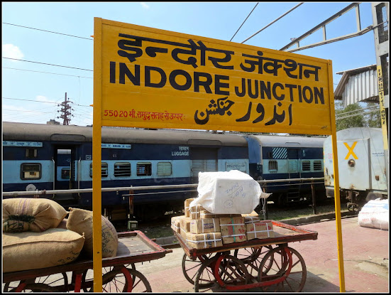
The economy of the district is more or less dependent on motor transport and Agra Mumbai road is the main artery of the district, which covers a mileage about 90 kms. in the district. National Highway No-3 also called A.B. road is passing from south-west to north-east in the district. On this road two important cities i.e. Mhow and Dewas are situated. Metre gauge railway line of Western railway runs in the district on Khandwa, Ratlam, Ajmer section. Similarly broad gauge railway line passing by Dewas, Ujjain connects state’s capital to Indore. Indore is well connected by Bus, by Rail, by Air and by Broad Gauge. Trains are frequently running to Ajmer, New Delhi, Mumbai, Dehradun and Howrah. Indore found its place in the aviation-route map of India. Indian Airlines, Damania and Jet-Airways are providing aviation facilities. Flights from Indore to Gwalior-Delhi were scheduled every day. The length of railway line is only 117.53 kms. comprising these sections viz. (i) Indore-Khandwa (37.03 kms), (ii) Indore-Ratlam-Ajmer (56.35 kms) and Indore-Dewas-Ujjain (24.15 kms), as per District Statistical Handbook 2010-11. In the district the total road length is 4160 kms. as reported under the transportation facility.60,624 trucks/three wheelers, 32,414 buses/mini buses, 16,413 taxis/three wheelers, 845,528 two-wheelers including mopeds/scooter motor, 19,471 cars/jeeps and 15,088 tractors and trolleys, 8,974 Trailers and 2,346 other vehicle were registered in the district in the year 2009-10. (Source : MP vividhe sankhiyiki 2011)
Land Use :
In the district the most common soil is the black-soil formed as a result of decomposition, which provides excellent crops in the northern part of the district. The Malwa region is well known for productivity and richness of soil with moderate climate and adequate rainfall. The soil of the region is heavy calcareous black clays with varying depth. The clay content generally varies from 45 to 55 percent. They have high moisture retentivity but have low infiltration rate resulting in run off soil erosion. The most important soil problems are difficulty in handling the soil once the monsoon sets in and water stagnation during the “kharif” season. These soils are generally low in nitrogen, low to medium in phosphorous, high in potash. These soils are highly prone to erosion particularly when these are without plant cover as follows during the rainy season. In the district the non-agricultural land is 36,523 hectares, uncultivable and barren land is 20,270 hectares, cultivable land is 178,911 hectares and waste land is 2,515 hectares .As reported forest area is 29,216 hectares. (Source: District Sankhikiya book - 2011)
Animal Husbandry :
Cattle constitute the wealth of the cultivators. A tenant’s capacity for sound economic life depends to a large extent upon them. In the district, the entire livestock population in the year 2010-11 consisted of 266,727 heads, out of which 110,164 belong to cow-dynasty 139,349 buffalo-breed, and rest others like sheep,goats,horse,donkey,camal, pig are 17,214. The poultry wealth is 372,153 With the aim of improvement of cattle breeds, artificial insemination centres/units have been established. To provide medical aid and assistance, there are 12 Veterinary Hospitals and 28 Veterinary dispensaries in the district. At the end of the year 2010-11, 83,969 cattle were treated and provided medical aid, 5,376 cattle were sterilized and 40,439 cattle were artificially inseminated in the district.Vaccinations for 149,978 cattle were served for protection from various diseases like Viderpest, Hemorrhagic Septicemia infections and anthrax which are very common diseases, which affect the livestock. At Mhow, at a distance of about 21 kms from Indore on A.B. road has sprung up a veterinary college and a livestock research Institute with two ancillary organisations i.e dairy farm and a poultry farm. This is the only institution in the country which claims to integrate such organisation in one single unit. There are three “Goshallas” in the district. Shri. Ahiliyawata Goshalla, Indore, Shri Ahiliyawata Goshalla, Moghapura and Shri Radhakrishna Goshalla, Mhow. (Source: District Sankhikiya book - 2011)
Fisheries :
Indore district is abound with a number of rivers, viz, Chambal, Gambhir, Choral, Sukhli and Kanada and several nullahs and tanks, viz, Sukhniwas, Bilaoli and Yeswant Sagar. Various indigenous varieties of fishes are found in them such as catfishes, Notapterus, Pabda, Wallago, Mahaseer and Kharpata. Most of the indigenous varieties are surface and column feeders. The tanks are infested with thick vegetation which serves both as food and as protection for the fishes. Major crop varieties of fishes have been taken up for development. They are considered as the most economical varieties to develop. In the initial stages the fish seed had to be brought from outside, viz. the river Narmada in Nimar district Nagda Tank (District Shivpuri) and Gwalior. The size of the fishes by nature is generally small. Now the Fisheries Department of the state goverment. is trying to improve the economy of pisciulture and as a preliminary step has taken up the work in Yashwat Sagar Bilaoli and Sukhniwas tanks.
Industries :
The cotton produced at Indore was the lifeline of the Textile industry at England. The mills were established in England. The cotton grown at Indore and Nimar was sent to England. Due to the state patronage and various facilities, the trend of establishing mills in Indore began in 1909. A company from Mumbai, established, the Indore Malwa United Mills Ltd. with 500-100 ms. Maharaja Tukoji Rao Holkar III himself inaugurated it on December 2, 1909. Hukum Chand Mill in 1916, Swadeshi cotton and Flour mill in 1921, Kalyanmal Mill in 1923, Rajkumar mills in 1924 and Nandlal Bhandari Mill in 1925 came in quick succession. With the establishment of these mills Indore acquired the status of one of the premier textile centres of India. Besides the cotton textile mills there are Hosiery Industry, cotton ginning and pressing factories. Oil Mills, Dal Mills, Bakeries, Sugar Mill, Sugar confectionery, Thymol factory, Furniture (wooden and metal), Paper manufacture, Printing presses, Chemical and Pharmaceuticals, Bricks and Tiles Manufacturing, Asbestos product, Basic Metal industries, Electrical Machinery and Appliances, Iron and Tin products, leather factory, Soap manufacturing, Industrial Arts, Jewellery, Gota Kinari Craft, etc. Indore is well known as “The commercial capital” of the state. Trade and commerce at Indore has a close resemblance with Mumbai. New fashion technology or just the business culture comes in very fast to Indore. Hence, sometimes it is also called “Mini-Bombay”. Apart from having big industries, factories, shops and show rooms of all the national and international brands, Indore is also known for its leather toys morevoer, Maheshwari and Chanderi are some very interesting ornate sarees and brocades on offer. There is a lot of Zari work coming form Madhya-Pradesh and the Maheshwari sarees have particularly gained in popularity. There are total 907 industrial units in the district. The number of registered small industries is 85 and small-scale industries units are 822. In the field of large scale industry, cotton mill, Sugar mill etc. are in the district.


0 टिप्पणियाँ